


![Shelter of SURSUR [Remastered] V2.0 : mascot horror gameplay walkthrough](https://techcratic.com/wp-content/uploads/2025/09/1757050237_maxresdefault-360x180.jpg)


![Canon PIXMA TS6420a All-in-One Wireless Inkjet Printer [Print, Copy, Scan], Works with…](https://techcratic.com/wp-content/uploads/2025/09/61x6KTFR8yL._AC_SL1500_-360x180.jpg)


![BASENOR 2026 2025 Tesla Model Y Juniper Mud Flaps Splash Guards [No Drilling No Tape]…](https://techcratic.com/wp-content/uploads/2025/09/61gaE1EKtZL._AC_SL1500_-360x180.jpg)


2025-09-01 04:14:00
blog.firedrake.org
There’s a new offline mapping program for smartphones, so I thought
I’d see how it stacks up against the one I’m already using.
For clarity: I’m using the F-Droid releases of both
OsmAnd and Organic
Maps. I believe
that OsmAnd charges for map downloads if you get it from other places.
Both programs work most readily with maps loaded onto the device in
advance (which is why I feel I should choose—I don’t want to have maps
for both taking up space). Both of them run off OpenStreetMap data,
adapted into a custom format and published as roughly monthly updates
on their own servers. Both have a tendency to let you accidentally
rotate the map rather than locking north at the top forever. Both have
vaguely shadowy and possibly exploitative governance. How do they
differ?
Organic Maps is much newer and generally less featureful than OsmAnd;
conversely OsmAnd can feel bloated and over-complex.
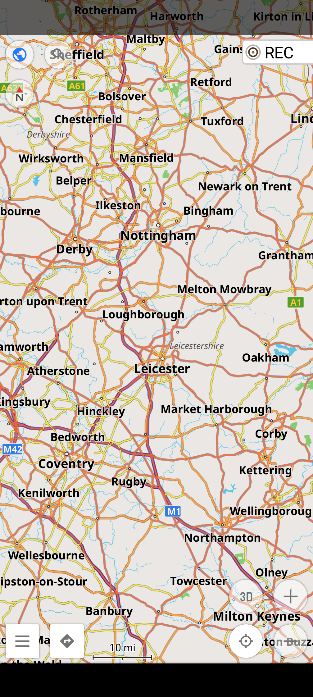
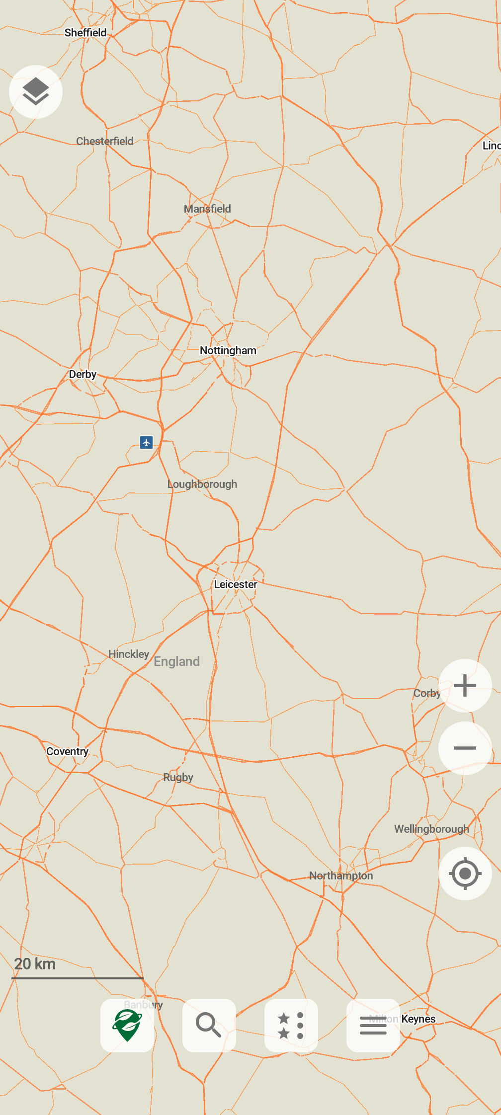
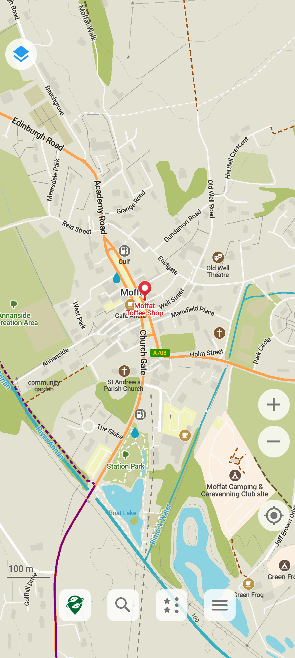
OsmAnd shows more information by default; Organic Maps is cleaner.
(OsmAnd is ferociously configurable, though.)
(All screenshots are taken on a Pixel 8 Pro; I’ve tried to line things
up to make views as similar as possible, but any error is mine.)
OsmAnd has standard map profiles; Organic Maps lets you bring in
specific layers for “Outdoor”, “Hiking” etc.
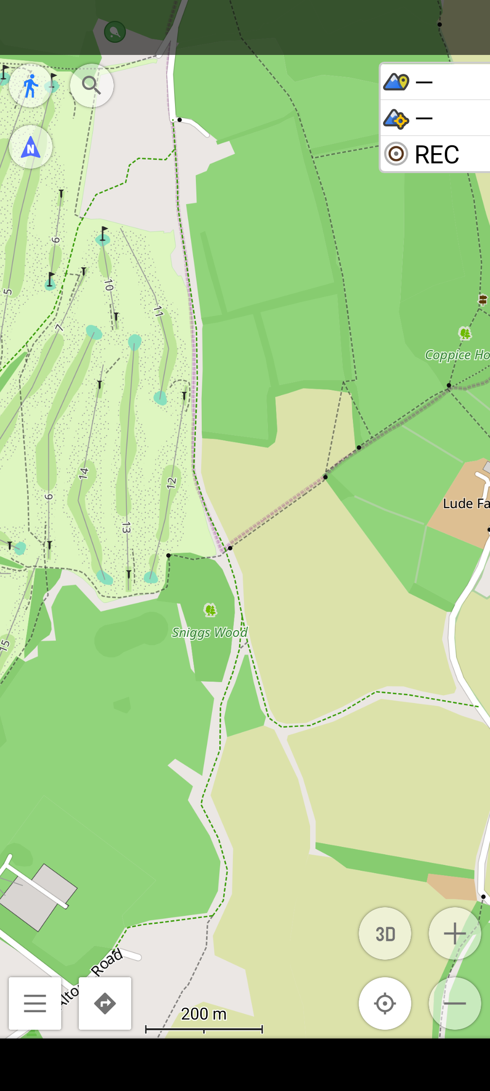
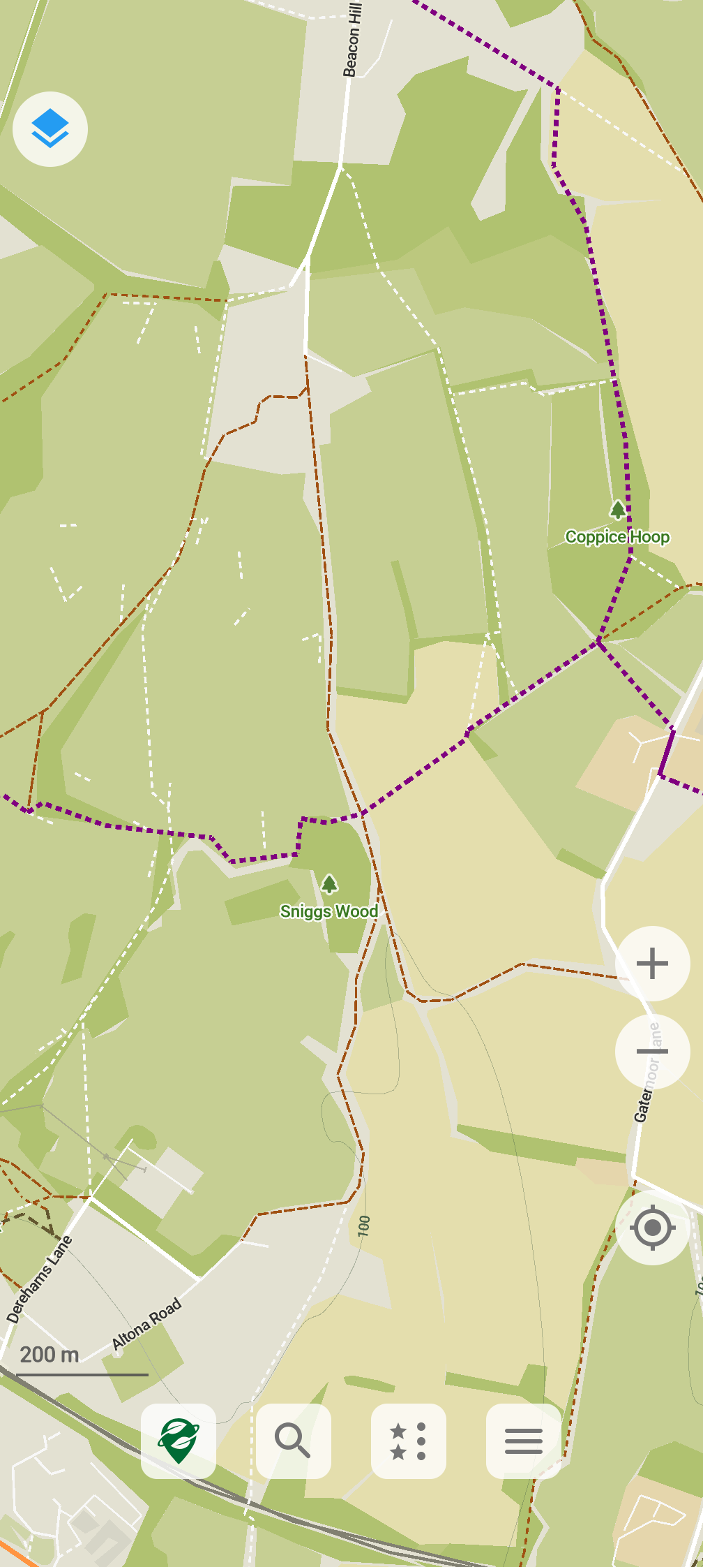
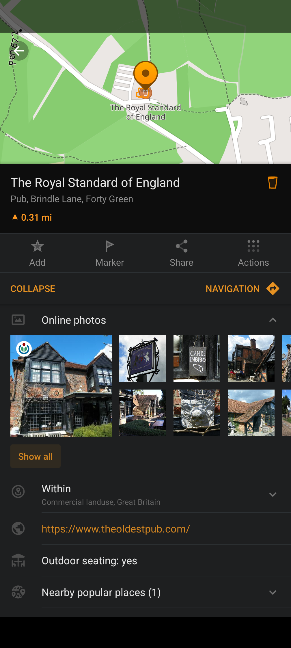
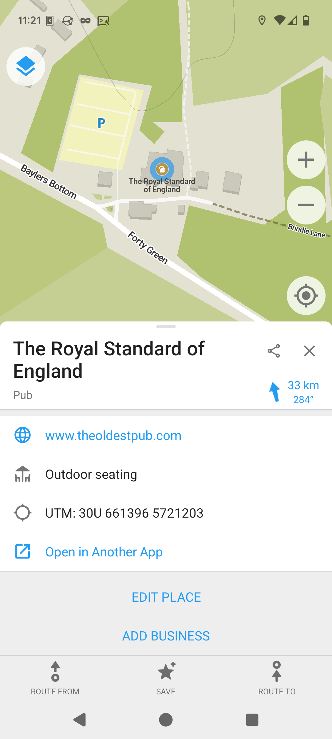
OsmAnd has the full OpenStreetMap data for objects; Organic Maps only
shows the object type. (The full data can include opening hours, not
always reliable but useful to have.) Correction: Ilmari kindly
pointed out that if you drag a thing which to me does not look
obviously draggable you get the full data. His screenshot below on the
right.
OsmAnd has a water navigation mode; Organic Maps doesn’t. (I don’t
often use this, but when I’m on a ferry I like to be able to see
what’s nearby in terms of buoys and other navigation aids.)
Both programs allow one to add local place markers, and load them from
a GPX file. OSMAnd allows markers to be different colours and shapes,
and have different symbols in them; Organic Maps allows for a text
label, which I suspect wouldn’t work well on OSM’s busier default map.
OsmAnd’s public transport route finder uses bus data. Organic Maps’
doesn’t. (The timings are anyone’s guess.)
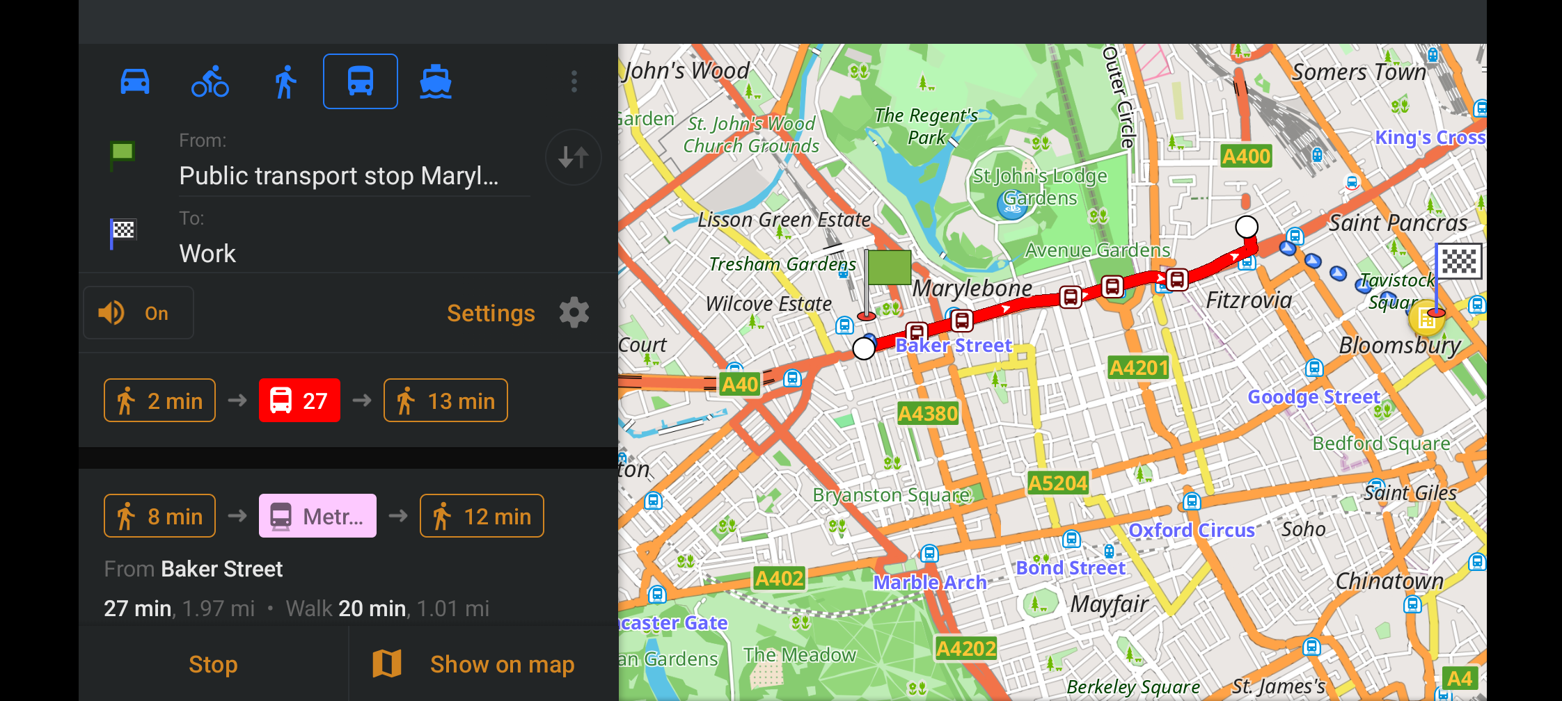
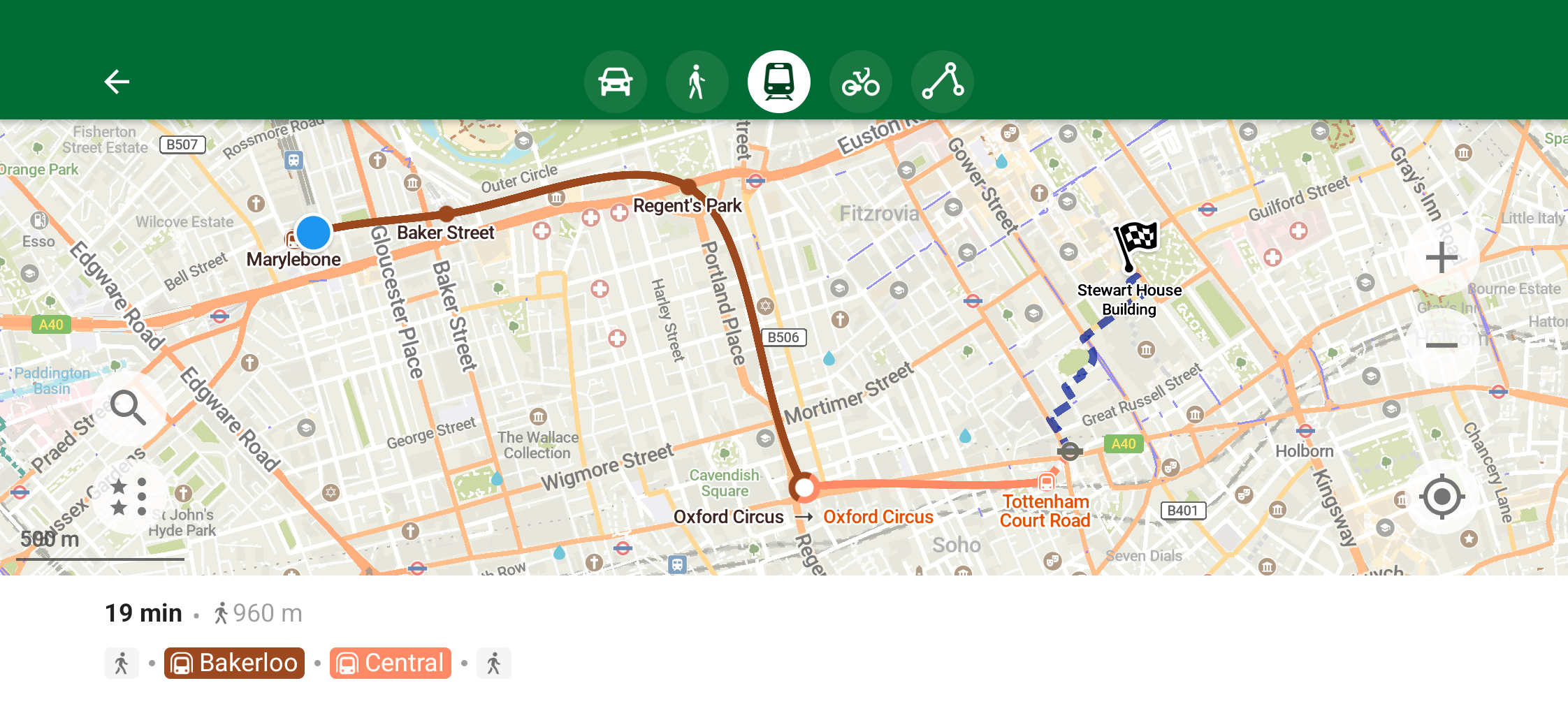
OsmAnd can even display a bus route and step through it stop by stop.
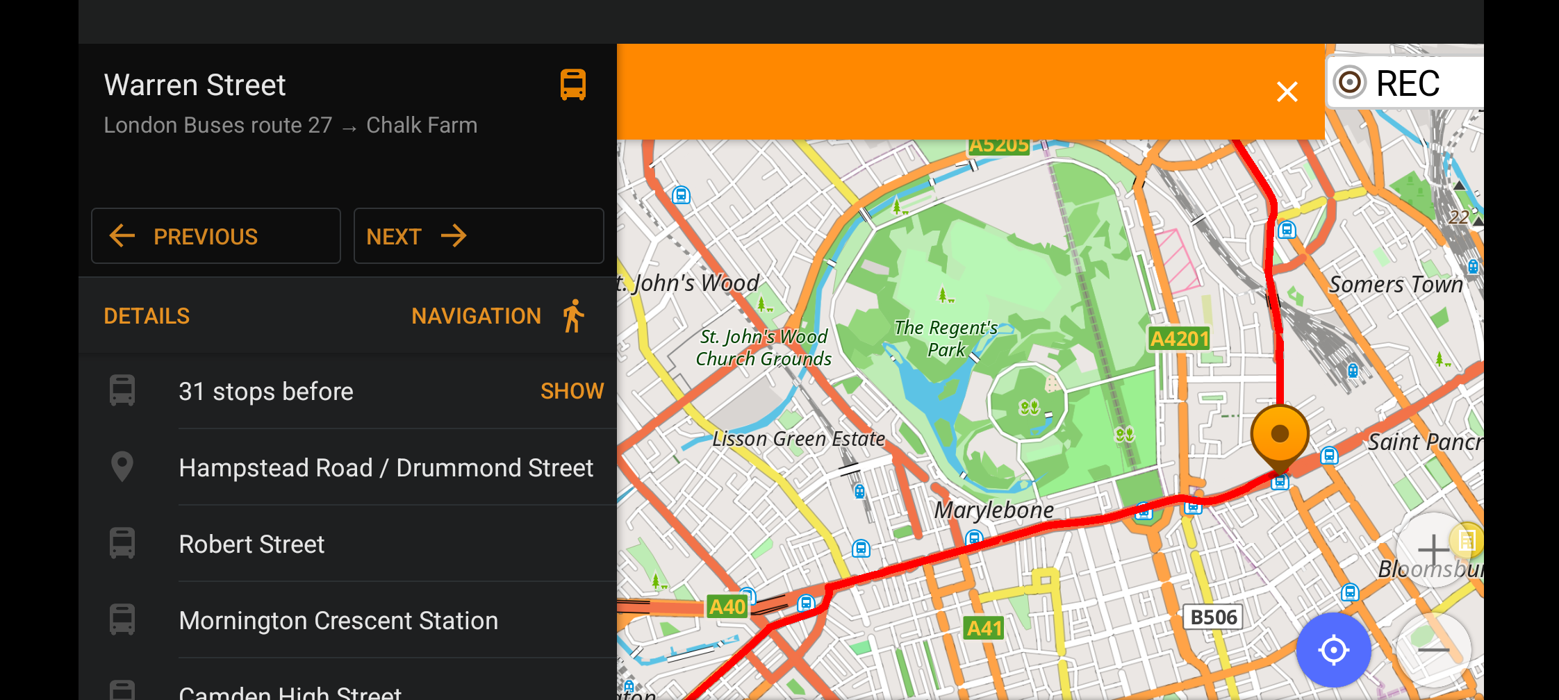
OsmAnd can be set to record tracks at configurable time intervals (I
use one second, which I know uses power but gives me the information I
want), and periodically (in my case every 60 seconds) upload position
information to a selected server; I wrote my own. Organic Maps can in
theory record tracks but only at its standard resolution (which
seems, to be every 16 metres or so), and can’t call out to an
external site.
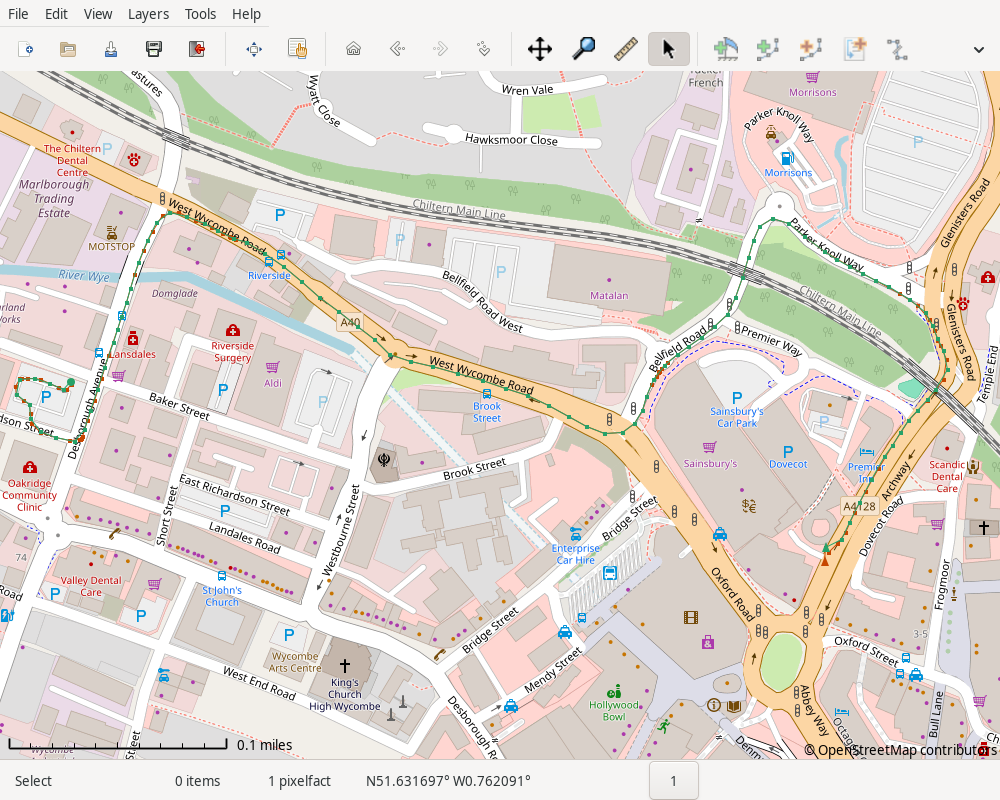
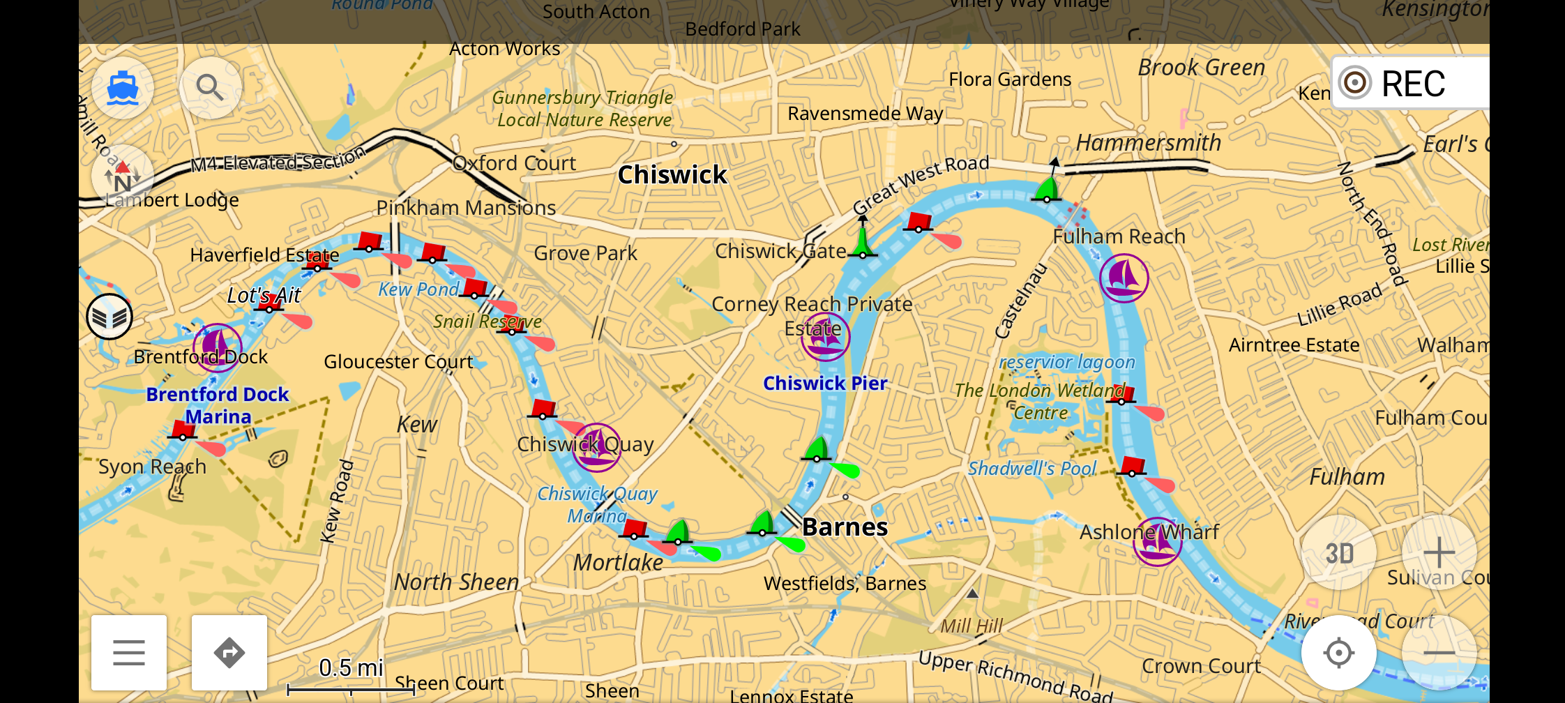
These are the tracks from a short drive in High Wycombe. OsmAnd’s is
in red, Organic Maps’ in green. (Both were exported as GPX and
rendered on the desktop in Viking.) Clearly
they’re very similar; most of the time the green covers the red. But
observe, on the right, the cluster of red on Bellfield Road; and, on
the left, the cluster while turning off Desborough Avenue. Both of
these involved driving slowly, and the one per second recording of
OsmAnd captures this detail while the Organic Maps track loses it.
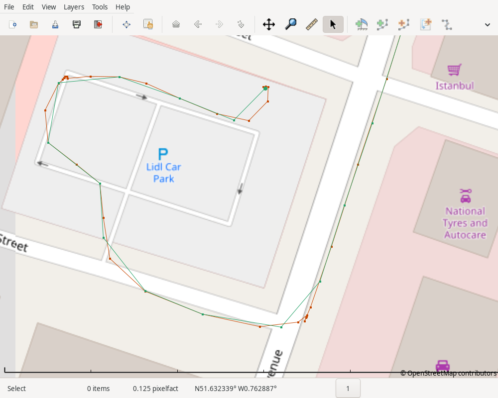
At the end of the trip, the intervals become even more obvious; at the
NW corner of the car park, I drove slowly while waiting for a clear
road, and Organic Maps loses that detail.
For my purposes I’ll stick with OsmAnd for now, but I’m definitely
interested to see how Organic Maps develops.
Keep your files stored safely and securely with the SanDisk 2TB Extreme Portable SSD. With over 69,505 ratings and an impressive 4.6 out of 5 stars, this product has been purchased over 8K+ times in the past month. At only $129.99, this Amazon’s Choice product is a must-have for secure file storage.
Help keep private content private with the included password protection featuring 256-bit AES hardware encryption. Order now for just $129.99 on Amazon!
Help Power Techcratic’s Future – Scan To Support
If Techcratic’s content and insights have helped you, consider giving back by supporting the platform with crypto. Every contribution makes a difference, whether it’s for high-quality content, server maintenance, or future updates. Techcratic is constantly evolving, and your support helps drive that progress.
As a solo operator who wears all the hats, creating content, managing the tech, and running the site, your support allows me to stay focused on delivering valuable resources. Your support keeps everything running smoothly and enables me to continue creating the content you love. I’m deeply grateful for your support, it truly means the world to me! Thank you!
|
BITCOIN
bc1qlszw7elx2qahjwvaryh0tkgg8y68enw30gpvge Scan the QR code with your crypto wallet app |
|
DOGECOIN
D64GwvvYQxFXYyan3oQCrmWfidf6T3JpBA Scan the QR code with your crypto wallet app |
|
ETHEREUM
0xe9BC980DF3d985730dA827996B43E4A62CCBAA7a Scan the QR code with your crypto wallet app |


Please read the Privacy and Security Disclaimer on how Techcratic handles your support.
Disclaimer: As an Amazon Associate, Techcratic may earn from qualifying purchases.


